World Bank Launches New Wind Atlas at the heels of Katowice Climate Meet
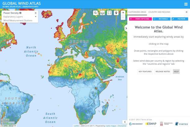
An updated Free Global Wind Atlas 2.3 is launched by the World Bank Group in collaboration with the Department of Wind Energy of the Technical University of Denmark.
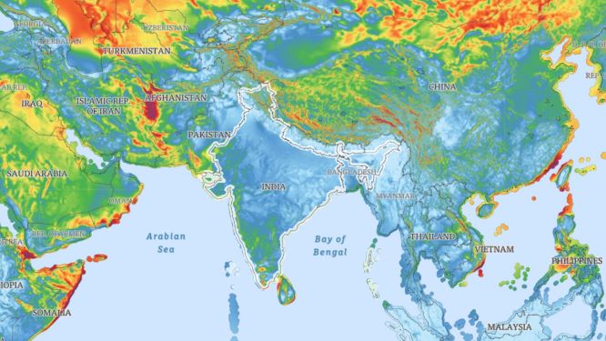
GWA is a free, web-based tool which has can be used as a complete one-stop solution for policymakers and investors looking to identify potential high-wind areas for wind power generation virtually anywhere in the world.
According to the World Bank, India is one of the top 10 users and the site has 9000 active users whose numbers are also increasing.
The new version was closely launched after the September launch, as reported earlier, to follow the UN Climate Change Conference in Katowice (COP24, 2-14 December).
New Features include:
- Update power density data taking geographical variations of air density into account
- Add three new map layers with gross Capacity Factor for three IEC classes of 3.45 MW wind turbines with rotor diameters of 112m, 126m, and 136m, at hub height 100m.
- Add 2 new types of wind roses for customized areas: ‘Wind Speed Rose’ and ‘Wind Power Rose’
- Download GIS files for all wind layers per area of interest
- Extending the Map generation tool with color scaling features
- Map generation of customized areas
- Update RIX and Orography layer to 250m
- Include legend ‘highlighter’ (moving arrow) responding to mouseover on map
In this new version, the group has introduced capacity factor layers for three IEC classes of 3.45 MW wind turbines, at a hub height of 100 m and taking geographical variations of air density into account.
Another major improvement is the updated power density layer, which is now also taking geographical variations of air density into account, i.e. accounting for the elevation variations of the terrain as well as the barometric reference information (mean temperature, mean pressure and relative humidity) from CFSR reanalysis data.
The user interface of the GWA website also has some important new features, like the ability to generate maps of customized areas and edit the color scaling of maps. It is now also possible to download GIS files for all wind layers, for any area of interest.
The GWA is being developed in partnership with the World Bank Group, with funding provided by the Energy Sector Management Assistance Program (ESMAP). The collaboration has earlier launched a Global Solar Atlas and Renewable Energy Mapping last year.